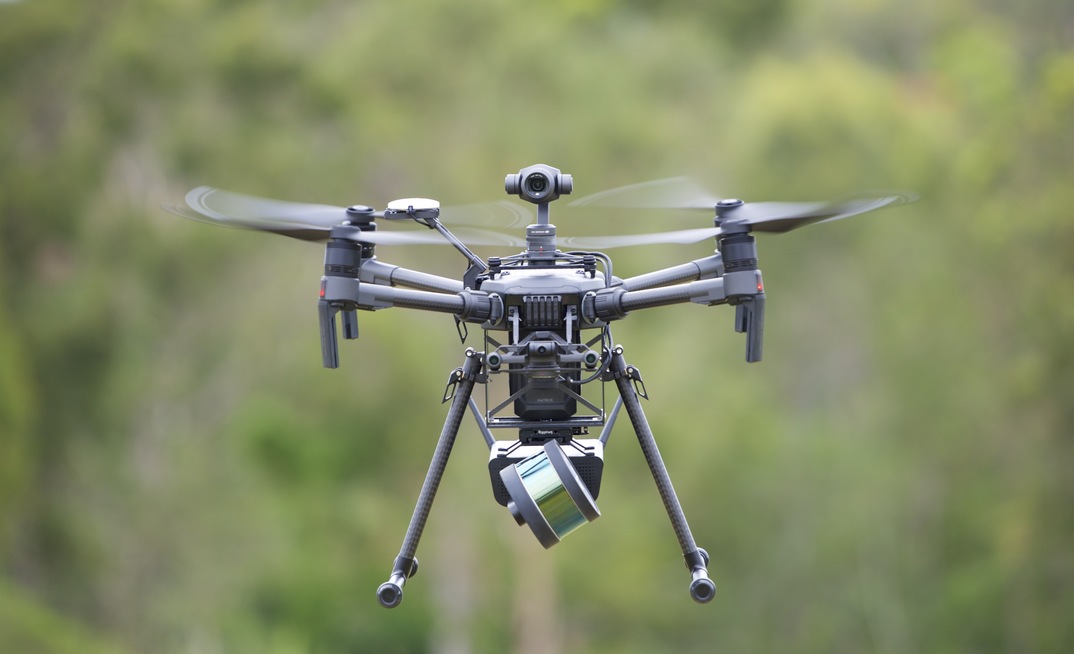


The company said Hovermap, a self-contained and plug-and-play payload product, can significantly improve drone-based asset inspection and mapping values.
Hovermap, which provides world-leading SLAM (simultaneous localisation and mapping) capability to permit accurate LiDAR mapping even when GPS is not available, includes omni-directional LiDAR-based collision avoidance and GPS-denied flight; this allows the safe flight of drones underground, indoors or in close proximity to structures.
"This [device] provides a step change in the data collection possibilities for mining, energy, construction, asset management and many more," Emesent CEO and co-founder Stefan Hrabar said.
"There is increasing demand for these industries to digitise and remotely inspect their assets, but access to hazardous areas and the lack of GPS has been a limiting factor until now. Hovermap's unique capabilities are helping to overcome these hurdles."
For underground mining specifically, Hrabar said Hovermap can help map hazardous, inaccessible areas like stopes and ore passes, keeping surveyors safe and providing needed data at an unprecedented resolution and quality.
"This data provides new valuable insights, leading to productivity gains and increased safety from better understanding of the geology," he added.
Hovermap's commercial launch is the culmination of half a decade of research and development, Emesent said, and 18 months of extensive testing by sites in the US, Canada, Australia, China and Japan - one customer of which has taken numerous trips with the device.
"We've been using Hovermap to fly into inaccessible areas of underground mines to map them. We've conducted more than 60 commercial flights in 12 mines, capturing extremely valuable data for our clients without putting humans at risk. Hovermap truly is a game-changer for underground mining and other GPS-denied environments," Matt MacKinnon of Canadian-based UAS Inc. said.